Discovering the Ligurian Riviera
Diano Marina–Andora Bike Path: A Complete Guide
April 11, 2026
- Diano Marina–Andora Bike Path: Quick Facts
- Where is the bike path between Diano Marina and Andora?
- How long is the route, and what is it like?
- The history: from the 1872 railway to today’s bike path
- The complete route: from Diano Marina to Andora, section by section
- Section 1 — Capo Berta and the Unfinished: the starting point
- Section 2 — Sant’Anna District in Diano Marina: the first section between the sea and the olive groves
- Section 3 — Via Villebone: the boundary between the city center and the new villas
- Section 4 — Old Diano Marina Station: the point where the journey changes
- Section 5 — Downtown Diano Marina: Between the Railroad and Roman History
- Section 6 — Borgo Paradiso and Via Saponiera: Amid Gardens, Olive Trees, and Local History
- Section 7 — Madonna della Rovere: the historic sanctuary of the Gulf of Diano
- Section 8 — San Bartolomeo al Mare: Modern Churches and Development Along the Railroad
- Section 9 — Cervo–San Bartolomeo Station: a station shared by two towns
- Section 10 — Il Porteghetto: the old fishing village of Cervo
- Section 11 — Capo Cervo: the headland where rock meets sea
- Section 12 — Capo Mimosa: the headland between Cervo and Andora
- Section 13 — Marina di Andora: From Fishing Village to Seaside Town
- Section 14 — Andora Station: the terminus of the bike path
- Transportation: From Imperia to Andora Without a Car
- Who is the Diano Marina–Andora bike path suitable for?
- Families with children
- Road bikes and more experienced cyclists
- Walking tours
- E-bikes and non-motorized transportation
- Practical tips for getting the most out of the bike path
- Choose the right moment
- Be careful with shared points
- Stops along the way
- Water and sunscreen
- Recommended bike type
- Parking and Access
- Our recommendation
There is a specific moment when a road ceases to be just a road and becomes a memory. It happens when you cycle along the Diano Marina–Andora bike path, a route that for 144 years has borne the weight of trains, the whistle of locomotives, and the clanging of the tracks.
Today, that route has been transformed into a new, completely flat seaside bike and walking path that connects Diano Marina to Andora, following the former coastal railway line that was decommissioned in 2016. It is an easy, scenic route accessible to everyone, located in the heart of the Gulf of Diano.
But there’s more. This section isn’t isolated: it’s part of a larger project that will gradually connect the entire Riviera di Ponente, allowing cyclists to ride traffic-free from Imperia all the way to Andora.
The stretch between Diano Marina and Andora is about 10 km long and winds through villages, headlands, and coastal spots that are often overlooked by those traveling by car.
What you’re about to read isn’t just a guide to the Diano Marina–Andora bike path: it’s a section-by-section account of this route, with everything you need to know before setting off.
Diano Marina–Andora Bike Path: Quick Facts[ back to menu ]
Length: approximately 10 km Route: from Diano Marina to Andora Surface: paved and smooth Elevation gain: almost none Difficulty: easy Suitable for: families, city bikes, e-bikes, leisurely rides Average time:
- by bike: 40–60 minutes
- on foot: 2–3 hours
Highlights along the route:
- Capo Berta and Incompiuta
- Diano Marina (downtown and train station)
- Borgo Paradiso
- San Bartolomeo al Mare
- Deer
- Mimosa Point
- Andora Marina
Links:
- westward: Imperia and the Riviera dei Fiori bike path (under construction)
- to the east: Laigueglia and Alassio
Direct access: The bike path runs about 650 meters from Agriturismo Le Girandole and is easily accessible on foot from both the agriturismo and nearby towns.
Diano Marina Bike Path
Where is the bike path between Diano Marina and Andora?[ back to menu ]
The Diano Marina–Andora bike path runs along the western Ligurian coast, between the Gulf of Diano and the border with Andora, closely following the route of the old coastal railway line, which was decommissioned in 2016. This is precisely its main attraction: a straight, flat route that stays close to the sea and passes through some of the area’s most picturesque towns.
The route connects Diano Marina, San Bartolomeo al Mare, Cervo, and Andora directly, creating a continuous path through villages, scenic views, and stretches of coastline that are often hidden from the main road. It is approximately 10 km long, entirely dedicated to cyclists and pedestrians, with no motor vehicle traffic, making it ideal for both cyclists and walkers.
For those arriving from the west, the starting point is at Capo Berta, where the bike path connects (or will connect seamlessly) to the “Incompiuta” project, the section currently under development that will link Diano Marina to Imperia. This segment, funded by PNRR funds and scheduled to open on June 22, 2026, represents a strategic step toward creating a seamless connection along the entire Riviera.
For more information on this section, you can also read the article dedicated to the “Incompiuta” in Diano Marina.

Once completed, the connection will allow cyclists and pedestrians to continue westward along the existing Riviera dei Fiori cycling and walking network, which runs from Imperia to Ospedaletti. Here are the routes that are already open:
- the bike path in Imperia
- the Riviera dei Fiori bike path from Imperia to Bussana Mare
- the bike path from Bussana Mare to Ospedaletti
To the east, however, the route extends all the way to Andora, completing a continuous stretch that, for the first time, allows you to travel along this part of the coast without ever sharing the road with cars.
In other words, the bike path between Diano Marina and Andora is not just a local route: it is a central hub of a larger network that, once completed, will connect much of the western Ligurian Riviera in a sustainable and accessible way.
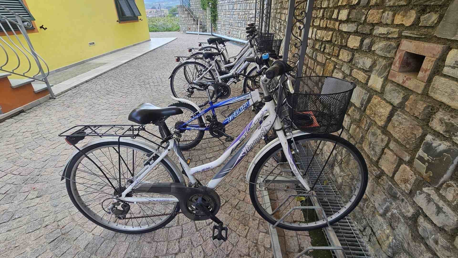
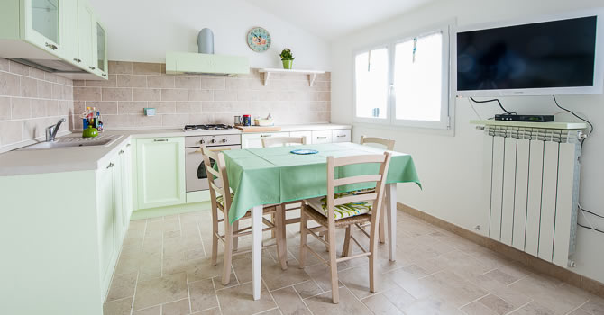
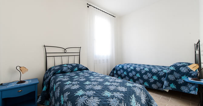
For those staying in the area, there’s also a significant practical advantage: the trail passes just a few hundred meters from Agriturismo Le Girandole, specifically along the stretch of Borgo Paradiso and Via Saponiera. It’s an ideal location for direct access to the trail without using a car, allowing you to set off in complete comfort. Guests of the property can also take advantage of free bicycle rentals, perfect for exploring this stretch of coastline easily and effortlessly. Discover our vacation apartments in Diano Marina.
From Agriturismo Le Girandole to the Diano Marina bike path
How long is the route, and what is it like?[ back to menu ]
The Diano Marina–Andora bike path is about 10 km long and follows the route of the old coastal railway. This means the path is completely flat and straight, with no hills or challenging sections.
There is virtually no elevation gain, because 19th-century railways were designed to avoid steep gradients. Today, this feature makes the bike path accessible to everyone, even those who aren’t in shape.
The difficulty level is easy. It is suitable for:
- families with children
- casual cyclists
- walking tours
- city bikes and e-bikes
The path is paved and even throughout its entire length, designed for use by cyclists and pedestrians. You can ride safely at all times, with no direct car traffic, and only a few crossings of local roads.
The route connects Diano Marina to Andora via San Bartolomeo al Mare and Cervo, staying close to the sea the entire way without any major detours. It’s easy to follow: it’s a continuous line that runs along the coast.
Travel times are approximate:
- by bike: about 40–60 minutes
- on foot: 2–3 hours
It’s the kind of ride that requires no preparation: you just set off and pedal, without a care in the world.

The history: from the 1872 railway to today’s bike path[ back to menu ]
To truly understand the Diano Marina–Andora bike path, you have to start here: with the railroad that ran along this very same route for over a century.
It was 1872 when this section of the Genoa–Ventimiglia coastal railway line was completed. An event that radically changed the fate of the villages in the Gulf of Diano. Before the train, Diano Marina was accessible almost exclusively by sea or along the winding Via Aurelia; Cervo, though already charming, remained isolated; San Bartolomeo and Andora were local communities, poorly connected and far from tourist traffic.
With the arrival of the railroad, everything changed within a few years. Travelers from Turin and Genoa began to easily reach the Riviera, and the first lodging facilities, seaside villas, and gardens sprang up. In fact, tourism took shape precisely because of that railroad track.
The railway line ran just a few meters from the sea, squeezed between the coast and the hills, following a winding yet consistently smooth path. It was a single-track line, featuring level crossings, small stations, and short tunnels in the more challenging sections. For 144 years, until November 2016, this route marked the daily life of the towns it passed through: the passing of trains was a constant reference point, almost like a shared clock.
Then came the change. With the opening of the new, faster inland railway line, the old coastal line was decommissioned. The tracks were gradually abandoned, and for a time, that corridor between the sea and the villages remained in limbo, serving no specific purpose.
This is precisely where the idea for the bike path originated. The redevelopment of the railway right-of-way made it possible to transform a disused infrastructure into a completely new, accessible, and sustainable route. Today, the bike and pedestrian path closely follows that same route: same line, same location, but with a different rhythm—slow, quiet, and open to both walkers and cyclists.
Cycling here means traversing multiple layers of history at the same time: beneath your wheels lies the old railway line, and even deeper still, the traces of the Via Julia Augusta, the Roman road that connected these lands over two thousand years ago.

The complete route: from Diano Marina to Andora, section by section[ back to menu ]
The Diano Marina–Andora bike path follows the former coastal railway line and passes through some of the most interesting spots in the Gulf of Diano. It is a straightforward route, but far from monotonous: each section offers something different, from quaint villages and headlands to stunning views of the sea.
To help you find your way, let’s go through it step by step, from west to east, starting at Capo Berta and ending in Andora.
Section 1 — Capo Berta and the Unfinished: the starting point[ back to menu ]
Before diving into the heart of the journey, it’s worth understanding where we’re starting from. And in this case, the starting point is a story in itself.
Capo Berta is the promontory that separates the Gulf of Diano from the territory of Imperia: a rocky outcrop that drops almost vertically into the sea and has for centuries been one of the most significant geographical obstacles along this stretch of coastline. Before the arrival of the railroad, the Via Aurelia wound its way around it along a tortuous and arduous route.
With the construction of the railway line in 1872, a tunnel was cut through the promontory. It was one of the first projects of its kind along the route, made possible by the grueling work of the tunnelers—specialized miners who advanced through the limestone rock by just a few centimeters a day, using sledgehammers, chisels, and black powder charges. Less visible stories also remain from those works: accidents, injured workers, names that do not appear in official documents but are still part of local memory.
Today, this point also marks the connection to a more recent project. On the western side, toward Imperia, a bike and pedestrian path is under construction along the “Incompiuta”—the stretch of coastal road between Diano Marina and Imperia. Work began in September 2024, with €1.3 million in funding from the PNRR, and the path is scheduled to open on June 22, 2026. On the opposite side, toward Diano Marina, the path is already open to the public.
The Capo Berta Tunnel, with its rock walls and centuries-old darkness, remains a symbolic crossing point to this day: on one side lies the Riviera di Ponente, already connected by a continuous network of bike paths, and on the other, the Gulf of Diano, which opens up to the east.
The bike and pedestrian path starts right at the entrance to the former Capo Berta tunnel, which is currently closed. There are also plans to build a light rail line along this stretch, which is expected to connect Diano Marina with Imperia.
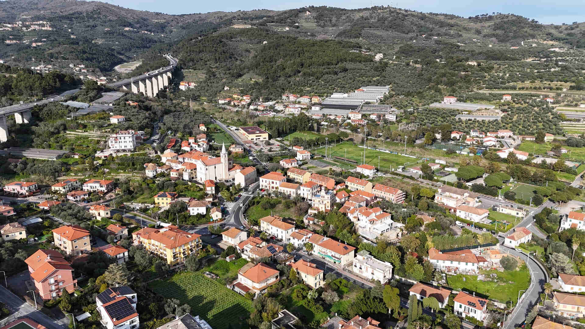
Section 2 — Sant’Anna District in Diano Marina: the first section between the sea and the olive groves[ back to menu ]
Leaving the Capo Berta area and heading east, the bike path enters the Sant’Anna neighborhood, the westernmost part of Diano Marina. This is where the town truly begins, and the rocky landscape gives way to the first houses.
Sant’Anna has always had a dual character: on the one hand, it is linked to the more maritime side of Diano Marina; on the other, it looks toward the agricultural hinterland. Olive groves mingle with homes, and the landscape still retains a semi-rural character today, quite different from the more urbanized areas of the town center.
The neighborhood takes its name from the Church of St. Anne, dedicated to the mother of the Virgin Mary. Her feast day, July 26, remains one of the most cherished events for the local community. St. Anne is traditionally the patron saint of mothers, grandmothers, and expectant mothers: a simple yet profound devotion, rooted in daily life rather than in grand official ceremonies.
For those who ride the bike path in the early hours of the day, this is also one of the most picturesque spots. The morning light streams in from the east, reflecting off the sea and casting a unique, almost painterly glow on the houses. It is the same light that 19th-century painters sought along the Riviera.
In the days of the railway, this stretch marked the last stretch of flat land before reaching the rockier terrain of Capo Berta. Trains coming from Andora and Cervo would slow down here as they entered the curve leading to Diano Marina station. Passengers sitting on the ocean side could enjoy one of the last unobstructed views of the Gulf at this point before arriving at the station.

Section 3 — Via Villebone: the boundary between the city center and the new villas[ back to menu ]
Continuing eastward, the bike path crosses Via Villebone, an area that vividly illustrates the urban development of Diano Marina. The name itself has a specific meaning: the “ville bone,” or the elegant residences built between the late 19th century and the early decades of the 20th century, when the town began to expand along the railway line.
In this section, the railroad track was not merely a transportation infrastructure, but a true urban boundary. On one side, toward the sea, lay historic Diano Marina: the town center, the waterfront promenade, the square, and the fishermen’s houses. On the other side, inland, stood the villas with gardens and the new buildings associated with the growth of seaside tourism. The railroad clearly separated these two worlds, and every level crossing represented a point of transition between different eras and lifestyles.
Then there is a less obvious aspect, yet one that remains vivid in the memories of those who lived here: the rhythm of the trains. It wasn’t a constant, intrusive noise, but a steady succession of passes. The trains would arrive, pass through the neighborhood, and then disappear, leaving room for silence once again.
For the locals, it had become a daily fixture. The children knew that the 8 o’clock train meant it was time to go to school, while at home, the passing of the 1 o’clock train was the perfect time to put the kettle on. It was a shared, simple rhythm that marked the passage of the day without the need for clocks.
With the decommissioning of the railway line in November 2016, that sound came to a halt. Today, the bike path has brought a different rhythm: slower, quieter, and more closely connected to the people who use it. It’s a noticeable change that has completely transformed the way this part of the city is experienced.

Section 4 — Old Diano Marina Station: the point where the journey changes[ back to menu ]
Continuing eastward, the bike path reaches one of the most iconic spots along the entire route: the old Diano Marina train station, which opened in 1872 and remained in operation for 144 years.
For those arriving from the north, this was their first real glimpse of the Riviera. Stepping off the train meant finding yourself in a small square, breathing in the salty air of the Gulf, seeing the palm trees, the flowers, and that light you don’t find in inland cities. That was the moment when the vacation truly began.
Today, the view is different. As you ride along the bike path from Diano to Andora, the station marks the transition from the town center to the more open stretch of the route. Here, the path widens, the houses become fewer and farther between, and the sea takes center stage once again.
Just a short walk from the station stood—and can still be partially recognized today—Villa Scarsella, one of the historic residences that came into being thanks to the railroad. On the Riviera in the late 19th century, it was common to build villas as close as possible to the stations, to make arrivals more convenient for owners and guests. Villa Scarsella fits into this context: a residence likely in an eclectic or Art Nouveau style, with a garden, veranda, and decorative details typical of the era.
This section provides a vivid account of how the railroad transformed Diano Marina into a tourist destination, bringing travelers, new buildings, and new ways of life. If you’d like to learn more about the history and evolution of the town, you can also read the article dedicated to Diano Marina and the Gulf of Diano.
Anyone who has old photographs of the station or Villa Scarsella now possesses a precious record of this era: a glimpse of that stretch of the Riviera that the train once made accessible and that the bike path is, in a sense, bringing back to life.
Diano Marina Bike Path (Former Train Station)
Section 5 — Downtown Diano Marina: Between the Railroad and Roman History[ back to menu ]
The bike path then winds through the heart of Diano Marina. For over a century, the railroad ran right through here, right in the middle of town rather than on its outskirts. Trains were part of everyday life: they weren’t just a means of transportation, but a constant, familiar presence—almost like a neighbor.
This section holds one of the most interesting and least known aspects of the route. Not far from the current municipal sports field, excavation work has uncovered remains believed to be from Roman-era structures, likely a rustic villa or settlements associated with a permanent presence in the area.
This is no coincidence. This flat strip of land at the foot of the Diano hill, sheltered from the north winds, well exposed to the sun, and close to the sea, was already an ideal place to live and build in Roman times. We are located along the route of the Via Julia Augusta, the road commissioned by Emperor Augustus between 13 and 12 B.C. as a coastal alternative to the Via Aurelia.
During the excavations, fragments of black-glazed pottery and sigillata pottery were discovered, along with terracotta roofing elements such as tegulae and imbrices, as well as remains of painted plaster and traces of masonry structures. These are tangible signs of a presence dating back more than two thousand years.
Cycling here means traversing multiple layers of history at the same time: beneath the asphalt of the bike path lie the railway tracks, and even deeper still, the Roman road. If you’d like to learn more about this, you can also read the articles on Lucus Bormani and the Diano Marina Civic Museum.
Diano Marina City Center Bike Path
Section 6 — Borgo Paradiso and Via Saponiera: Amid Gardens, Olive Trees, and Local History[ back to menu ]
This is one of the most iconic sections of the trail, partly because of its location: it’s about 650 meters from Agriturismo Le Girandole and is one of the easiest to reach without a car.
Borgo Paradiso is not a recent or contrived name. It already appears on 19th-century cadastral maps of the Municipality of Diano Marina and aptly captures the identity of this area. The “paradise” referred to is not something abstract, but a real place: a mild climate, lush vegetation, and a distinctive light that struck those arriving here from the north.
At the end of the 19th century, the first middle-class vacationers stepping off the train from Genoa or Turin found themselves facing a landscape completely different from the one they had left behind. Gardens, palm trees, orange groves, and villas nestled in the greenery: a transformation made possible precisely by the railroad, which brought not only goods and fishermen, but also new ways of life and living.

Via Saponiera, just a little further on, tells a different story, one linked to the local economy. In Liguria, olive oil production was often linked to soap making: lower-quality oils and processing residues were used in artisanal soap factories.
The street name most likely indicates that one of these businesses was once located right here in this area. These were by no means marginal enterprises: soap made from Ligurian oil, using techniques similar to those of Marseille soap, was a widely available and sought-after product, also destined for markets in Genoa and on the French Riviera.
This stretch of the bike path was thus home to a complete production chain: olive trees on the terraces, oil mills, soap factories that processed the byproducts, and the railroad that connected everything to the main trading centers.
Today it’s less noticeable, but you can still sense it. When cycling here, especially on hot days, you might catch a scent in the air that’s hard to describe: slightly oily, with a floral note. It’s one of those details that help you see the landscape in a different light.
Diano Marina Old Station to Via Saponiera Bike Path
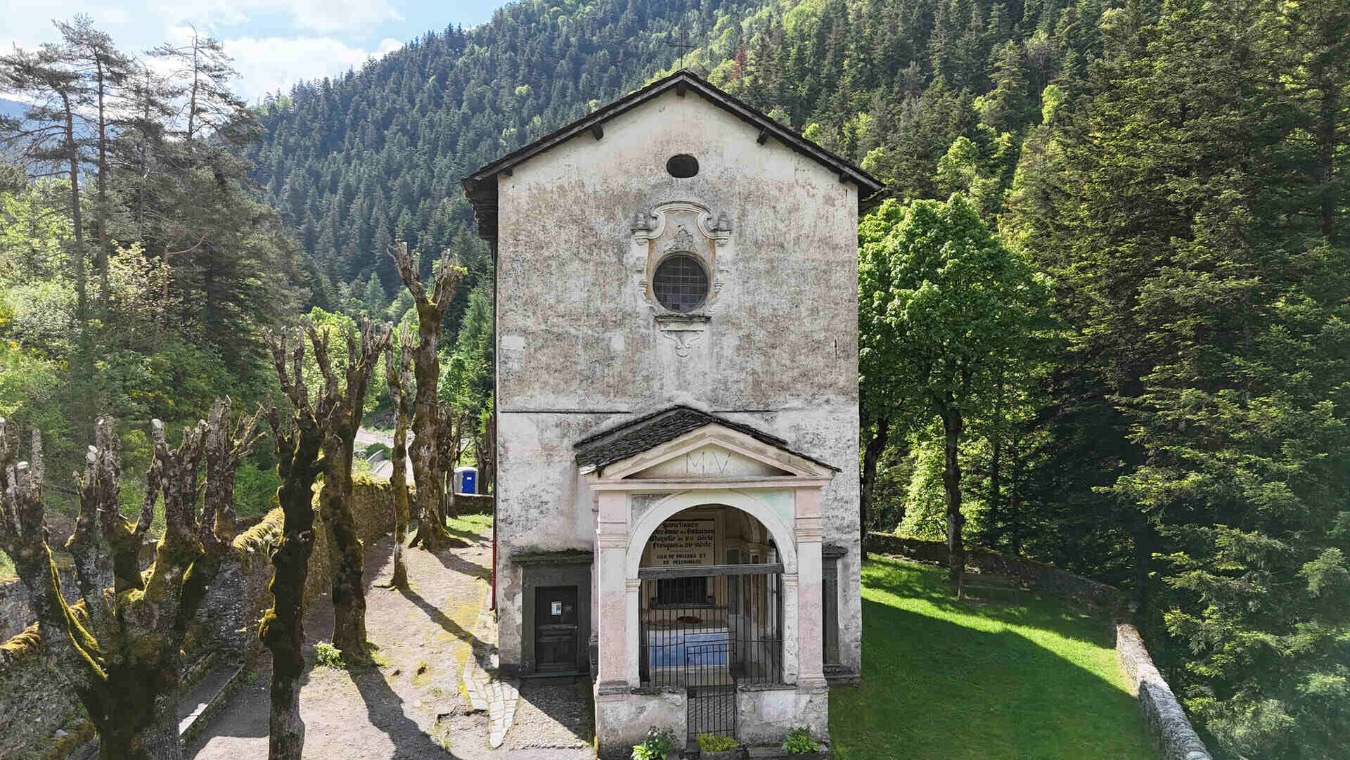
Section 7 — Madonna della Rovere: the historic sanctuary of the Gulf of Diano[ back to menu ]
If there is one spot along the Diano Marina–Andora bike path where history truly comes alive, it is this one: the Madonna della Rovere hill, one of the most important and symbolic places in the entire Gulf of Diano.
The sanctuary, located in the municipality of San Bartolomeo al Mare, is the oldest and most revered in the area. The old railway line ran right past it, never severing its connection to the local area, and remained there for over a century.
The earliest documented references to a chapel dedicated to the Virgin Mary date back to the 14th–15th centuries, but oral tradition suggests that its origins are even older. According to legend, a sacred image of the Virgin Mary was found at the foot of an oak tree—the very oak that gave the sanctuary its name.

The choice of this tree is no coincidence. In Ligurian tradition, the oak is a symbol of strength and resilience: a sturdy tree capable of enduring over time and withstanding the harshest conditions. On a coastline that was exposed for centuries to raids by Barbary pirates between the 16th and 18th centuries, the image of the Virgin Mary associated with an oak tree offered tangible protection to local communities.
Sailors setting out on fishing trips or coral-gathering expeditions to Sardinia would climb up here to ask for protection. Upon their return, they would leave a mark of their passage. Inside the sanctuary, the walls tell this story better than any document: they are covered with votive offerings, including painted panels, photographs, and votive objects spanning several centuries. There are scenes of boats in a storm with the Virgin Mary appearing among the clouds, images of soldiers who returned alive from war, and—a particularly significant detail—depictions of accidents that occurred at the level crossings of the old railroad, accompanied by the inscription “grace received.”
The connection between the shrine and the railroad is also evident in a specific incident. When the route was designed in 1872, the engineers had to take into account the annual procession of the Madonna della Rovere, which passed through that very spot every September. The solution was to build a level crossing positioned so as to allow the faithful to pass through.
For over 140 years, the procession has followed the same route, crossing the railroad tracks. Today, the railroad tracks have been replaced by a bike path: the route remains the same, but without barriers or delays. This is yet another way in which the new route blends into the history of the area without disrupting it.
Diano Marina Bike Path: Via Rovere, Via Saponiera
Section 8 — San Bartolomeo al Mare: Modern Churches and Development Along the Railroad[ back to menu ]
Continuing eastward, the bike path enters the town of San Bartolomeo al Mare and passes through what can be considered the most recently developed area in terms of urban planning. It is here that, over the course of the 20th century, the landscape underwent the most noticeable transformation, shifting from an agricultural area to an urban zone centered on beach tourism.
In this section, the bike path runs near two churches built in the last century, which differ significantly in style and location from the medieval parish church in the historic center. Their location is no coincidence: they stand along what used to be the railway line, specifically to serve the new neighborhoods that sprang up between the railroad and Via Aurelia.
Between the 1930s and the 1960s, this area gradually filled with vacation homes, lodging facilities, and permanent residences, giving rise to new communities. Churches thus became not only religious landmarks but also social hubs for both residents and vacationers.
The railroad also played a central role in daily life. There were two railroad crossings along this stretch, which are easily identifiable even on old maps. For years, they served as both a point of interruption and a source of rhythm: the barriers lowering, the warning bell, the train passing through the village just a few meters from the houses, and then life returning to normal. Entire generations grew up with this rhythm of life.
Bike path from San Bartolomeo al Mare to the border with Diano
Section 9 — Cervo–San Bartolomeo Station: a station shared by two towns[ back to menu ]
Continuing along the bike path, you’ll come to one of the most historically significant sites: the old Cervo–San Bartolomeo train station, which has been in operation since 1872.
Contrary to what one might think, San Bartolomeo al Mare did not have its own independent station. The two towns, Cervo and San Bartolomeo, shared a single station, located in the coastal area between them. This was a common practice for 19th-century railways, designed to optimize costs and distances.
From a technical standpoint, it was a logical solution, but in practice, there was no shortage of petty local rivalries. The station’s location, its name, its distance from the town center: every detail could become a source of friction between the two communities. This is a detail that speaks volumes about the character of these areas.
The building can still be seen today and stands as one of the most tangible reminders of this coast’s railway heritage. Cycling past this building, knowing its history, completely changes your perception of the route.
If you’d like to learn more about the historical and cultural context of the area, you can also read the article dedicated to Cervo, one of Italy’s most beautiful villages.

Section 10 — Il Porteghetto: the old fishing village of Cervo[ back to menu ]
After passing the Cervo–San Bartolomeo station heading east, the bike path enters a little-known area rich in history: Porteghetto. The name derives from the Ligurian dialect—u purteghetu—and means “small port.” It is, in fact, a small natural cove at the foot of the village of Cervo, which has been used for centuries as a landing place by local fishermen.
Before the construction of modern ports, this was one of the most important hubs for the area’s maritime economy. Here, boats were hauled ashore, repaired, and prepared for the following season. In particular, the coralline—the traditional boats used for coral fishing—were maintained during the winter and returned to the sea in the spring, when voyages to Sardinia and the coasts of North Africa resumed.

The Porteghetto was also a hub of trade. Historical records mention it as early as the 17th century as a marketplace: freshly caught fish was sold here, goods arrived from the sea, and families waited for the boats to return.
With the arrival of the railroad in 1872, this balance shifted. The track ran very close to the coast, physically separating the landing from the inland area. The railroad crossing in this area became one of the busiest: fishermen, carters, and local residents were forced to wait for trains to pass before crossing.
Today, Porteghetto is a small beach frequented mainly by locals, tucked away from the most popular tourist routes. With the completion of the bike path, it is set to become more accessible, but it remains one of those places that you can truly discover only by exploring the area at a leisurely pace.
Porteghetto-Cervo Bike Path
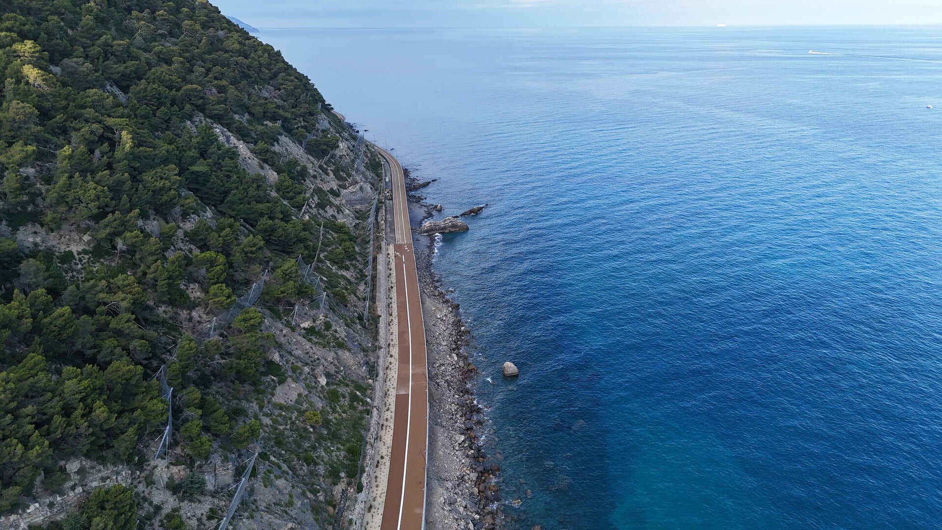
Section 11 — Capo Cervo: the headland where rock meets sea[ back to menu ]
Leaving Porteghetto behind, the bike path climbs toward Capo Cervo, the headland that marks the eastern boundary of the Cervo area. It is one of the most scenic spots along the route: a limestone outcrop jutting out into the sea, exposed to the wind and offering unobstructed views of the landscape.
Above it, the silhouette of Cervo Alto stands out clearly, with its medieval village and Baroque church overlooking the coast. Even when viewed from below, the village maintains a striking presence, seeming almost suspended between sky and sea.
For the engineers who designed the railway in 1872, this section presented one of the most complex challenges. The coastline here is steep and rugged, with places where the rock drops almost vertically into the sea. To cross the headland without creating excessive gradients, it was necessary to combine rock-cut tunnels with embankments.
The work was done entirely by hand, using simple tools such as pickaxes, sledgehammers, and black powder charges. Many of the workers involved in this project came from Piedmont and Lombardy, having been recruited to work on one of the most important infrastructure projects of the time.
Today, as you cycle along this stretch, the landscape changes noticeably. Looking east, the coastline opens up, and on clear days, when the tramontana clears the air, you can even make out the outline of Capo Noli, toward the Savona area.
Capo Cervo Bike Path
Section 12 — Capo Mimosa: the headland between Cervo and Andora[ back to menu ]
Once past Capo Cervo, the route enters one of the most spectacular sections of the entire bike path: Capo Mimosa, the long promontory that marks the transition toward Andora. In some local variations, it is also referred to as “Capo Mimosa–Rollo,” where “rollo” in the Ligurian dialect refers to a rocky ridge that slopes down toward the sea.
The name is closely linked to the presence of the mimosa (Acacia dealbata), which over time has become one of the most recognizable symbols of the Riviera di Ponente. Between January and February, the slopes of the promontory turn a vivid yellow, creating a spectacle that can be seen even from the open sea.
The mimosa, however, is not native to this area. It was introduced in the 19th century, likely by botanists and gardeners associated with the first vacationers who arrived on the Riviera via the railroad. It quickly adapted to the local climate, spreading widely across the sun-facing slopes.

Here too, the railroad played a decisive role. In the early decades of the 20th century, trains transported large quantities of mimosa to Genoa and Turin, helping to establish a thriving flower trade.
From a technical standpoint, Capo Mimosa was one of the most challenging sections of the railway line. The headland features steep, rocky slopes, which forced the engineers of the time to combine rock-cut cuttings, embankments, and short tunnels to keep the track close to the coast. The work was demanding and entirely manual, carried out by teams of seasonal workers who labored mainly during the more favorable months, when weather conditions allowed them to work along the cliff.
Today, this stretch is one of the most popular among cyclists. On one side lies the sea; on the other, the hills rise up toward the inland. Ahead, the outline of Marina di Andora and its harbor gradually comes into view.
Capo Mimosa Scenic Bike Path
Section 13 — Marina di Andora: From Fishing Village to Seaside Town[ back to menu ]
Heading east from Capo Mimosa, the bike path enters the town of Andora, reaching its coastal area: Marina di Andora.
Before the arrival of the railroad, this area was little more than a fishing village clustered around the Bastion, a defensive structure built to protect the community from attacks by sea. For centuries, from the 16th to the 18th century, the entire Ligurian coast was vulnerable to raids by Barbary pirates, and the Bastion served as a strategic point for controlling and defending the harbor.
With the arrival of the railroad in 1872, a process of transformation similar to that seen in Diano Marina and San Bartolomeo al Mare began here as well. The railroad connection made the area easily accessible and spurred the emergence of the first lodging facilities: guesthouses, hotels, and villas that accompanied the development of tourism in the Marina.
The Andora waterfront as we know it today—with its marina, well-equipped beaches, and seaside businesses—is the direct result of this transformation that began over a century ago.
The port deserves a special mention. The area where the modern marina stands today was already used as a landing place in medieval times. During the rule of the Marquises of Clavesana, between the 12th and 14th centuries, this location served as an important commercial hub for local goods bound for the western Mediterranean.
This tradition has never completely disappeared. Even today, alongside recreational boats, you can still see fishing boats setting out at dawn and returning with the day’s catch.

Section 14 — Andora Station: the terminus of the bike path[ back to menu ]
The route ends near the old Andora train station, which opened in 1872 and remained in service until November 2016.
Andora has always been a town divided between two distinct identities: Andora Castello, the medieval historic center perched in the inland hills, and Marina di Andora, which developed along the coast, particularly during the 20th century. As one might expect, the railroad ran along the coastline, serving mainly the coastal area.
The station was located right in the Marina area and served as a major hub not only for tourism but also for the local economy. Andora, in fact, acted as a link between the coast and the inland valleys of the Savona region, from which products such as olive oil, wine, timber, and medicinal herbs were shipped to larger markets.
The building followed the typical design of stations from that era: a two-story structure made of local stone, with railway facilities on the ground floor and the stationmaster’s quarters on the upper floor. But what made this place special was the kind of people who passed through it.
On one hand, there were the tourists—especially during the summer—with their suitcases and planned stays along the coast. On the other, there were the producers and merchants from the inland areas, who used the train to transport goods and reach the markets. Two different worlds that came together in the same space and shared the same waiting times.
Over the years, Andora has also been one of the towns involved in the gradual modernization of the Ligurian railway line. The transition from the old coastal route to the inland route took place gradually, creating a transitional period that many residents still remember. Today, the station building remains one of the most visible reminders of this past.
From here, for those who wish to continue, the bike path heads east toward Laigueglia and Alassio. The route between Diano Marina and Andora ends here, but the Ligurian coast stretches on uninterrupted, offering new stretches to explore.
Flower Riviera Bike Path: Cervo to Andora
Transportation: From Imperia to Andora Without a Car[ back to menu ]
The Diano Marina–Andora bike path is not a standalone route, but a key part of a larger project aimed at connecting much of the Riviera di Ponente without the use of cars.
To the west, the connection to Imperia is already partially complete and partially under construction. The key section is the “Incompiuta” stretch between Diano Marina and Imperia, currently under construction along the coastal road. Once completed (scheduled to open on June 22, 2026), it will allow cyclists to ride continuously between the two cities.
From Imperia, the bike path already runs along the Riviera dei Fiori, passing through towns such as San Lorenzo al Mare, Santo Stefano al Mare, Riva Ligure, Arma di Taggia, and Bussana Mare, before reaching Ospedaletti. It is one of the most popular bike and pedestrian paths in Liguria, completely separated from traffic and overlooking the sea.
If you'd like to learn more about these courses, you can check out:
- the bike path in Imperia
- the Riviera dei Fiori bike path from Imperia to Bussana Mare
- the bike path from Bussana Mare to Ospedaletti
To the east, however, the route continues from Andora toward Laigueglia and Alassio, following the coastline and connecting to other sections that are already in place or under development.
Once all the segments are completed, the end result will be a continuous bike and pedestrian path stretching along most of the western Ligurian coast. This route is designed not only for tourism but also for daily commuting, allowing people to travel between different towns without traffic, parking hassles, or interruptions.
This is the true value of the Diano Marina–Andora bike path: it’s not just a pleasant route to ride, but a concrete part of a larger network.

Who is the Diano Marina–Andora bike path suitable for?[ back to menu ]
The Diano Marina–Andora bike path is an extremely versatile route, suitable for a wide range of users precisely because of its simplicity: it is flat, has a smooth surface, and is free of through traffic.
Families with children[ back to menu ]
It is one of the best routes for families. With no hills, a paved surface, and a dedicated bike lane separate from traffic, you can ride safely even with young children.
It is suitable for:
- bike with a child seat
- baby strollers
- First independent rides for the little ones
In addition, the presence of towns and villages along the route makes it easy to stop frequently.
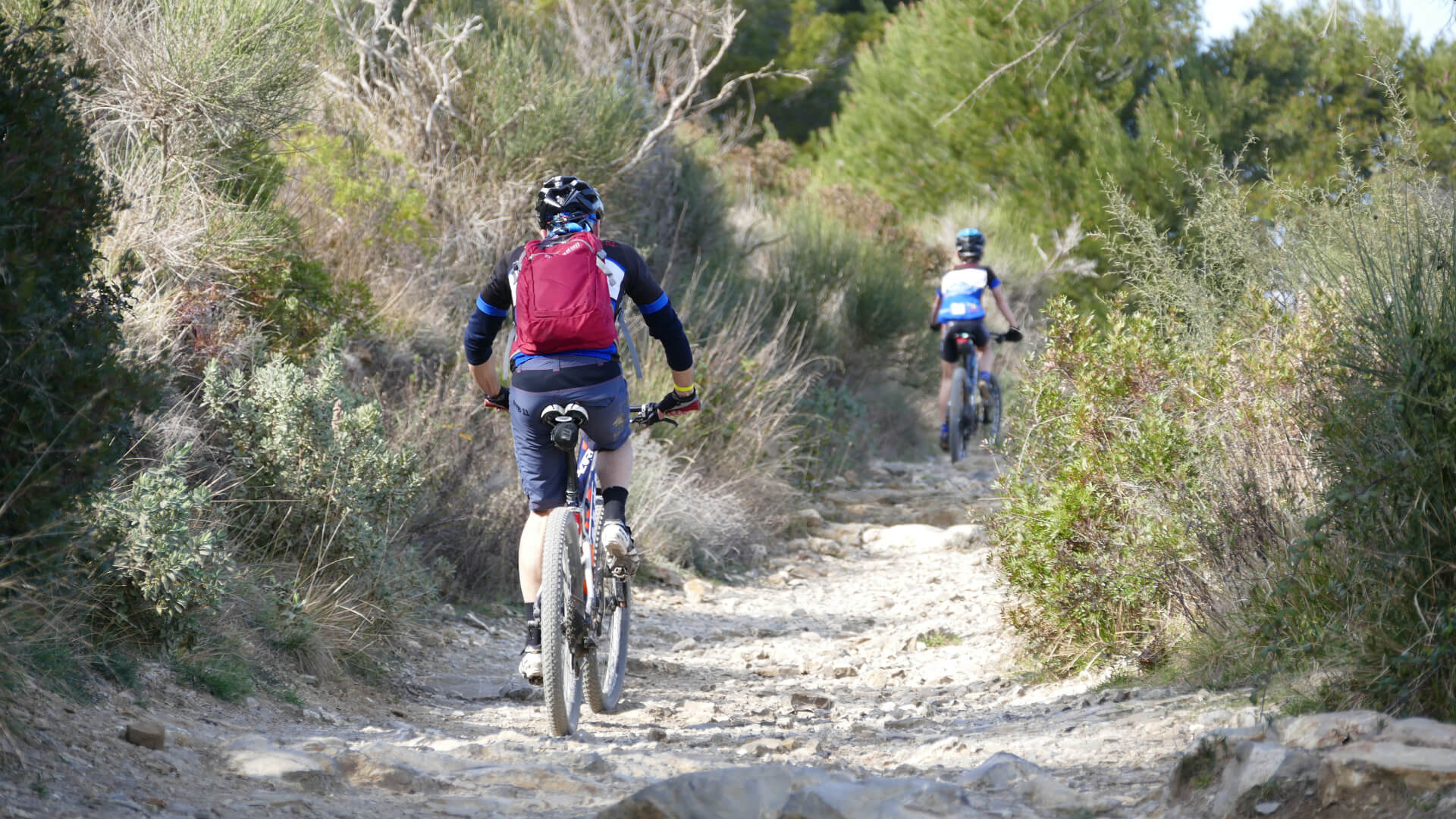
Road bikes and more experienced cyclists[ back to menu ]
For road cyclists, the route is perfect for:
- refreshing outing
- warm-up or cool-down
- a scenic stretch to include on longer rides
However, it must be made clear: this route is neither technically challenging nor demanding in terms of elevation gain. Those looking for elevation gain or a challenging workout will need to head inland.
Walking tours[ back to menu ]
The bike path is also popular with people who prefer to walk. Its smooth surface and moderate length make it easy to navigate, even in short stretches.
It is ideal for:
- walks with ocean views
- easy walks on flat terrain
- routes that are accessible even to those who aren't in shape
E-bikes and non-motorized transportation[ back to menu ]
This is one of the best places to ride an e-bike. The route is straight and uninterrupted, connecting several towns, making it perfect for both practical travel and leisure.

Practical tips for getting the most out of the bike path[ back to menu ]
The Diano Marina–Andora bike path is easy to navigate, but there are a few tips that can make all the difference and make the experience more enjoyable.
Choose the right moment[ back to menu ]
The route is very sunny, especially on the sections between Cervo and Andora.
- Early morning: better light and cooler temperatures
- Late afternoon: ideal in the summer
- Midday hours (July–August): intense heat and higher visitor numbers
In the winter months, however, it’s also perfect during the middle of the day.
Be careful with shared points[ back to menu ]
Even though the bike path is separated from traffic, in some sections:
- There are crosswalks
- pedestrians cross paths
- there may be access points to beaches or homes
It's best to always drive at a moderate speed, especially in built-up areas.
Stops along the way[ back to menu ]
One of the advantages of this route is that you can stop frequently. You can plan your trip in stages:
- a stop in Diano Marina
- one in Cervo
- one in Andora
This makes the route suitable even for those who don't want to tackle it all at once.
Water and sunscreen[ back to menu ]
It may seem obvious, but we recommend that you:
- Always bring water, especially in the summer
- use sunscreen
- keep in mind that the shadow is limited in several sections
Recommended bike type[ back to menu ]
The paved surface means you can ride just about any bike:
- city bike
- e-bike
- gravel
- road bike
No special technical equipment or tools are required.
Parking and Access[ back to menu ]
If you are not departing directly from Diano Marina or Andora:
- You can park your car in the parking lots in town
- easily access the bike path from multiple points along the route
This also allows you to travel only certain sections without having to cover the entire route.
Our recommendation[ back to menu ]
Don’t treat it as a simple trip from point A to point B. It’s a straightforward journey, but one rich in details: villages, scenic views, history. Take the time to stop along the way. That’s where the experience really changes.
Listen to all podcasts published on our official channels: